If you love the idea of strolling to coffee, catching a sunset by the water, and still getting to San Francisco without the grind, Alameda might be your spot. This East Bay island city blends small‑town main streets with sandy shoreline and marina views. You will get a feel for the neighborhoods, daily rhythm, housing styles, commutes, and practical stuff that locals weigh before they buy or rent. Let’s dive in.
Why island life feels different
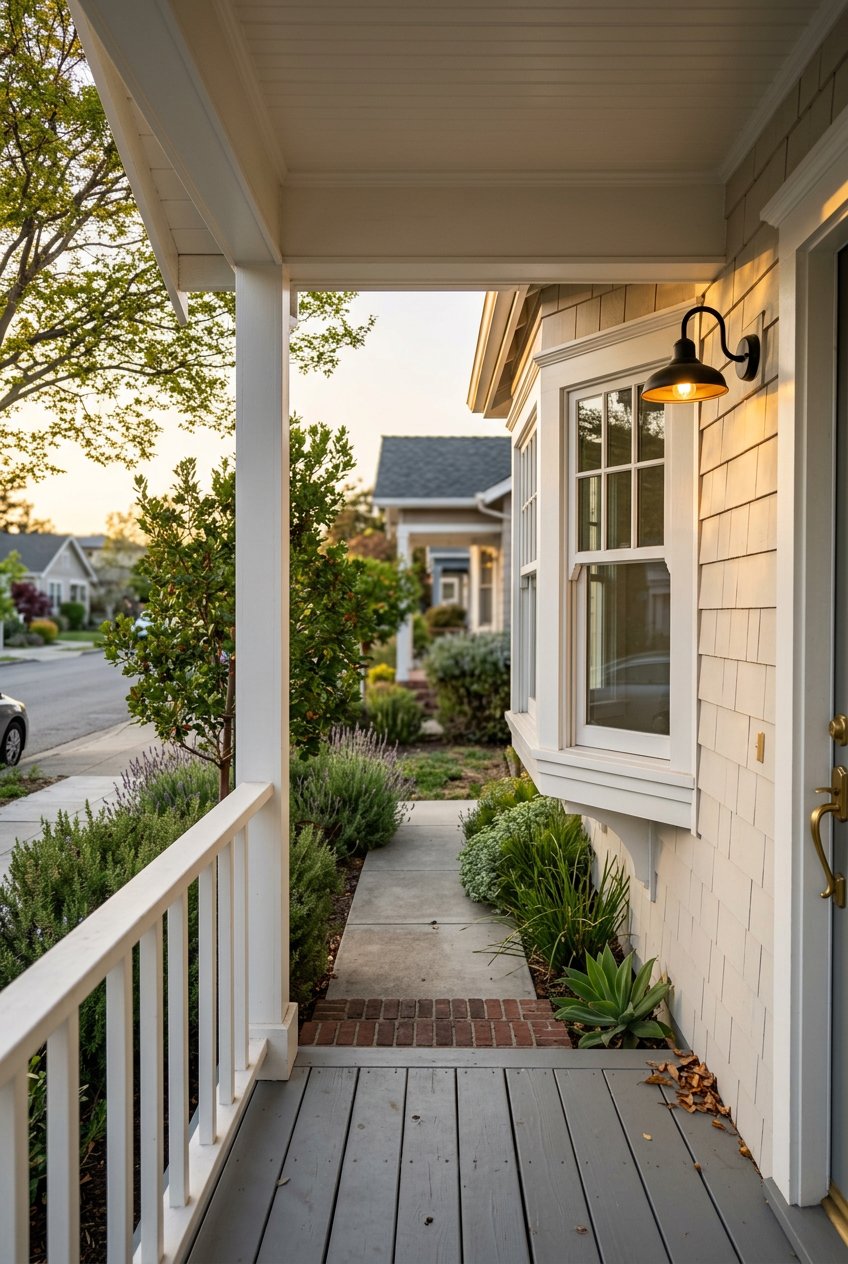
Alameda sits across the Oakland Estuary with underwater tubes and drawbridges connecting you to the mainland. That geography shapes life every day. You get compact, walkable blocks near Park Street, calm waterfront paths and beaches, and a quieter suburban feel on Bay Farm. It is a rare mix of tree‑lined streets, porches, and sidewalks that lead to marinas, the Bay Trail, and Crown Beach.
Neighborhood snapshots
Park Street and Central Alameda
Park Street is the island’s main retail and dining corridor, a historic four‑block spine packed with independent shops, cafés, and a classic movie palace. Street festivals and weekend events add extra buzz to the sidewalks. Explore the business directory and seasonal happenings through the Downtown Alameda Business Association. If you like to run errands on foot and bump into neighbors, this is where you will spend your time.
Gold Coast and West End waterfront
On the West End and along the Gold Coast you will notice mature trees, older grand homes, and pockets of waterfront parks. The city recognizes and preserves many of its historic resources in these areas, which adds to the character block by block. If you enjoy evening walks by the water and classic Bay architecture, start your scouting here and review the city’s historic resource listing for context.
Bay Farm and Harbor Bay
Bay Farm Island and Harbor Bay have a more suburban, planned feel with newer homes, greenbelts, and a commuter‑friendly ferry terminal. Weekday riders use the Harbor Bay ferry to reach downtown San Francisco, and the on‑water time is commonly about 20 to 25 minutes depending on route and schedule. You can see how the city describes ferry, bus, and bike options on its Get Around Alameda page.
East End and Crown Beach
On the East End you will find Crown Memorial State Beach and the Bay Trail for year‑round shoreline walks, cycling, and family outings. Crab Cove programs add easy weekend activities for all ages. Check the Crown Memorial State Beach page for current details and visitor information.
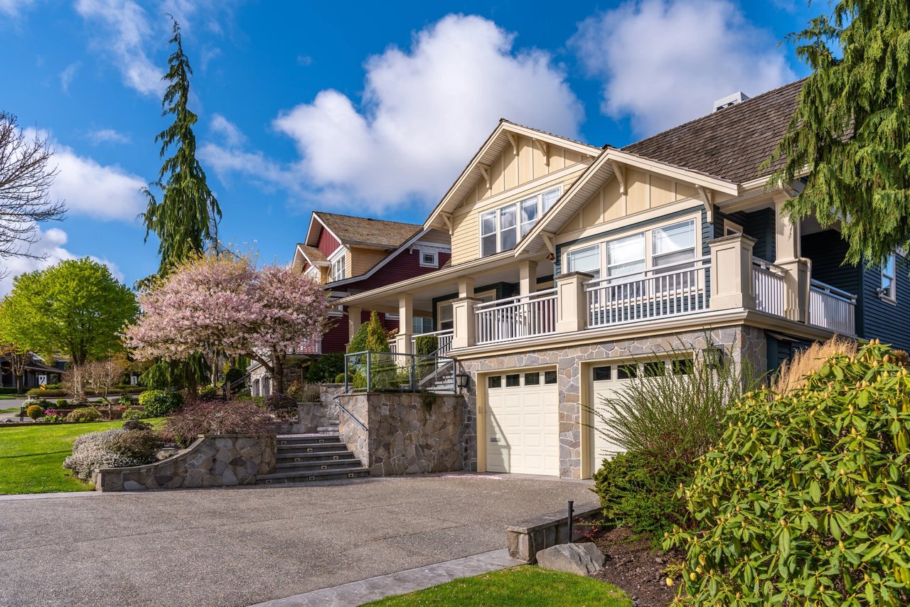
Homes and architecture you will notice
- Historic core: Many streets feature late 19th and early 20th century homes with Victorian details and Craftsman bungalows. Blocks are flat and walkable with mature trees and smaller yards compared with inland suburbs. The city’s historic resources help explain why these areas feel so distinctive.
- Waterfront condos and townhomes: Near marinas and at Alameda Point you will find condo and townhome communities with bay views and newer construction. Get a sense of what is planned at the former Naval Air Station through Alameda Point Partners’ vision.
- Bay Farm: Mid to late 20th century single‑family neighborhoods and some townhomes, with a more car‑oriented street pattern and easy access to the Harbor Bay ferry. The city highlights this area in its transportation overview.
Daily life: errands, eats, and weekends
Park Street is where you pick up bread, grab a coffee, catch a movie, and meet a friend for dinner. Street festivals bring music and art to the sidewalks throughout the year, and the association’s site keeps the Downtown Alameda calendar updated.
For bigger errands you will likely swing by South Shore Center or Alameda Landing for chain and big‑box options. A quick look at this East Bay malls directory will give you a sense of those hubs, including South Shore and Landing listings on one page from SF Station.
Weekends often start on the shoreline. You might walk or bike the Bay Trail, play at Crown Beach, or drop into a Crab Cove program. On first Sundays, the Alameda Point antiques scene is a local ritual that fills the former airfield with vendors; get a taste of the tradition here: Alameda Point Antiques Faire mention.
Getting around the island
There is no BART station on the island. Most residents combine AC Transit buses with BART in Oakland, take the ferry to San Francisco, bike for short trips, or drive through the tubes and drawbridges. The city’s Get Around Alameda guide explains routes, bike lockers, and ferry terminals on both the main island and Harbor Bay.
Driving times vary by time of day because tube and bridge congestion is common. Many commuters choose the ferry for a reliable and pleasant ride. Typical on‑water time to downtown San Francisco is about 20 to 25 minutes depending on terminal and route, with extra time for parking or walking.
Commuting checklist
- Ferry options: Main Street and Seaplane Lagoon on the main island, plus Harbor Bay on Bay Farm. On‑water time to San Francisco is commonly 20 to 25 minutes.
- BART access: Use AC Transit to reach nearby Oakland stations like Fruitvale or Lake Merritt.
- Bus routes: AC Transit connects neighborhoods to BART and transbay destinations. See the city’s transportation page for links and maps.
- Driving notes: Expect variable congestion in the Posey and Webster Street tubes and at drawbridges over the estuary.
- Bikeability: Flat grid, shoreline paths, and bike lockers near ferry terminals make short trips easy.
- Parking tip: The city manages meters and lots in the Park and Webster corridors. Check updated hours and tools on the Park & Webster parking page.
Practical things to know
- Schools and services: Alameda Unified School District operates neighborhood elementary schools, middle schools, and multiple high schools such as Alameda High and Encinal. Review the district overview on the AUSD page and confirm attendance zones directly with AUSD before you buy or lease.
- Parking and micro‑logistics: The city actively manages short‑term parking and turnover on Park and Webster. Policies can change, so verify current meter hours and payment options on the city’s parking page.
- Climate resilience and flood planning: Alameda is low‑lying and parts of the city sit on fill. The city’s Climate Adaptation and Hazard Mitigation Plan outlines projects and neighborhood pathways to address sea‑level rise, groundwater, and shoreline protection. Get the latest context on the CARP plan page.
Market snapshot
Home values in Alameda are high compared with national norms. As of January 31, 2026, Zillow’s snapshot showed a typical home value around 1,096,737 dollars and a median sale price near 1,010,000 dollars. Numbers shift month to month, so plan to verify current figures as you prep your search or sale. If you are comparing neighborhoods within the island, factor in condition, architectural style, yard size, and proximity to the shoreline or ferry.
What is ahead for Alameda
The former Naval Air Station is evolving into a mixed waterfront district with new housing, trails, and community amenities. For a sense of direction and site planning, review Alameda Point Partners’ vision. In parallel, the city is investing time and planning in long‑term resilience through its Climate Adaptation and Hazard Mitigation Plan. Both efforts point to a future that keeps the island’s waterfront identity front and center while preparing for sea‑level rise.
Thinking about a move on or near the island, or weighing Alameda against nearby Oakland neighborhoods? Let’s talk about your goals, budget, timing, and commute so you can make a confident plan. Connect with David R Valva for local guidance and a tailored strategy across Alameda and the East Bay.
FAQs
How does commuting from Alameda to San Francisco work?
- Most residents use a mix of AC Transit plus BART in Oakland, the Main Street or Seaplane Lagoon ferries on the main island, or the Harbor Bay ferry on Bay Farm, with on‑water time commonly 20 to 25 minutes.
Which Alameda areas are most walkable for daily errands?
- The Park Street and Central Alameda corridors offer the most walkable mix of shops, dining, and services, while Bay Farm and Harbor Bay feel more suburban and car‑oriented.
What recreation should I expect near Crown Beach?
- Crown Memorial State Beach provides a sandy shoreline, Bay Trail access, and year‑round walking and cycling, with family programs based at Crab Cove managed by East Bay Regional Park District.
Is flood or sea‑level rise a concern in Alameda?
- Yes, the city is actively planning for sea‑level rise, groundwater, and shoreline resilience; review Alameda’s Climate Adaptation and Hazard Mitigation Plan for current projects and priorities.
Where do I park when visiting Park or Webster Street?
- The city manages on‑street meters and nearby lots and provides updates on hours and tools like mobile payment on its Park and Webster parking page.